greater manchester boundary walk leg two
Presenting the second leg of my walk around the inside of the boundary of Greater Manchester, though with a slight cheat this week, since to cross the Mersey reasonably close to the boundary I had to take the Warburton Bridge, which is just outside Greater Manchester, as is a little of Manchester Road/Carrington Way.
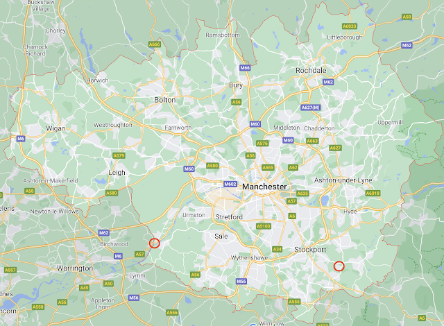
I've also run together the two legs so far onto a single map of around 48 km (approx 30 miles, don't @ me, I can't be bothered to figure it out exactly). That looks like a lot of progress, but compare to the map nicked off of Google at the bottom of the page. So far, in two weeks, I've only travelled from the red circle on the right to the the red circle on the left.
There's a lot of boundary remaining. Per my comment last week that an estimate of eight weeks to complete the circuit might be optimistic, there could be another eight, nine, or more walks still to do. Bearing in mind that I have to walk to and from home, and that for parts of the west and north in particular, that will take eight hours or more of the day, even as the hours of available daylight drop below that.

Comments